Tongariro Alpine Crossing: Bookings, Shuttles and When to Cancel
Tongariro Crossing booking made plain - the free DOC track pass, shuttle prices from National Park, Turangi and Taupo, and the checks that say when to cancel.
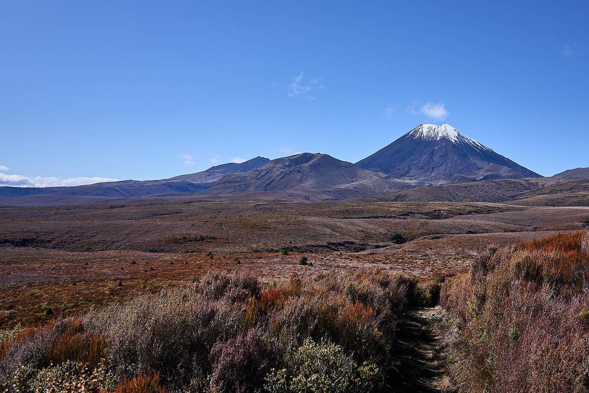
Book the Crossing: The Free DOC Track Pass
The Tongariro Alpine Crossing is free to walk, but you cannot just show up. The Department of Conservation requires every walker to hold a booking — a track pass you reserve through DOC before setting out on the 19.4 km route between Mangatepopo and Ketetahi car parks. It costs nothing. A lot of sites get this wrong and call it a permit, or quote a price for it; there is no fee and no permit, only a booking. Make it once your date is roughly fixed, and change it when the date moves, which happens more often than you would think, because the mountain gets a vote too.
One change is on the way: a NZ$20–40 international visitor fee for the crossing is planned for around late 2027. Almost nobody covers this yet, so most pages — this one included — still describe the walk as free, which it is for now. If you are reading this after late 2027, check DOC's booking page for the current charge before assuming the pass costs nothing.
Weather is the reason the booking matters less than the cancellation call. Conditions on the crossing can shift from clear skies to whiteout within 30 minutes, and helicopter evacuations happen most seasons, usually when a southerly front catches walkers near Red Crater with no escape route left. So this page does three things: book you in, set out the shuttle options and the cancellation norms, then give you the forecast checks that tell you when to stay off the track.
Tongariro Crossing Shuttles: Prices and Departures
The track starts and finishes at different car parks, so unless you have two cars and a very patient driver, you need a shuttle. From National Park Village or Turangi, expect roughly NZ$65–75 return; from Taupo it costs more, because the drive to the mountain is longer. Four departures a day is the typical schedule, and the first run of the morning is the one that sells out first in summer — book a day or two ahead rather than hoping for a seat.
Cancellation norms are simple on one side and stingy on the other. If DOC closes the track or the operator cannot run, you get moved to another day or refunded without argument. Cancelling for your own reasons is different: operators generally want notice the evening before, and a same-day no-show usually forfeits the fare. If the forecast looks wrong the night before, message the operator then, not from the trailhead at 6 am.
Tongariro's Alpine Climate and Hazard Zones
How Tongariro's Terrain Drives Rapid Weather Shifts
The volcanic terrain of Tongariro creates its own microclimate that standard national weather models miss. The summit plateau rises from 1100 metres at Mangatepopo to 1967 metres at Tongariro summit, forcing moist westerly air to cool and dump rain on western slopes while the eastern Desert Road side stays in a sharp rain shadow. When reading the Tongariro forecast, note a 10 degree drop and 40 km/h wind rise can occur within 400 metres of ascent. DOC rangers report sudden fog banks form over Red Crater and Emerald Lakes basins with under 15 minutes warning on 8 of 10 unstable days. These fog events, combined with the rain shadow keeping eastern track sections dry, create false security for walkers checking Tongariro track status online. On 3 August 2024, the DOC alert feed warned of zero visibility at Ketetahi due to fog while lower farm section stayed sunny. Safety on the crossing depends on expecting whiteout even when lowland signs look clear. Lowland weather apps NZ like basic smartphone widgets pull data from Taupo (370 metres) or National Park Village (800 metres), missing alpine pressure changes on the crossing. A proper read of the Tongariro forecast uses MetService's dedicated alpine forecast and NIWA's high-resolution terrain model, which on 12 January 2025 predicted 60 km/h gust at Red Crater two hours before generic apps showed 20 km/h. The no-go signals are clear when specialised sources show wind over 50 km/h or rain above 5 mm per hour. Smart planning means cross-checking DOC alerts with the mountain forecast instead of city forecasts.
Weather Hazards You Face on the Alpine Crossing
The Tongariro Alpine Crossing climbs to Red Crater at 1886 m, where hazards build quickly. Reading the forecast means tracking wind chill and wet conditions that cause hypothermia. On 15 March 2023, DOC logged 4 C air with 45 km/h gusts at Mangatepopo, a wind chill near -2 C. A rain soaked hiker exposed to such wind loses core heat in 30 minutes, so weather judgment on the crossing is critical for survival. Low visibility hits when the ceiling drops. NIWA data shows the ceiling often sinks below 1000 m on unstable days, sometimes to 800 m at the saddle. The poled route disappears. The 19.4 km crossing has no emergency shelter, so whiteout conditions turn a walk into a rescue scenario. Checking NZ weather apps hourly reveals these drops. The weather decision should cancel the walk if midday cloud stays under 1200 m. DOC alerts and track status show when the crossing is unsafe. During ice on Red Crater or storm warnings, the track closes. In July 2024, three walkers were rescued after ignoring an ice alert in 70 km/h winds. If sustained wind exceeds 60 km/h, ice forms, or thunderstorms loom, postpone. Recheck the forecast on hike morning.
Trusted Forecast Sources for Tongariro
Getting Official Mountain Forecasts from MetService
Slow travel planners use the MetService Tongariro alpine forecast as the base for any weather call on a Tongariro hike. The official page is under the Mountains section of metservice.com, with a dedicated Tongariro National Park area covering Ruapehu, Ngauruhoe and Tongariro summits. To reach it, select Mountains, choose Central Plateau, then Tongariro. The display separates conditions into summit plateau, alpine pass and valley track, and reports wind, precipitation, ceiling and visibility. For a practical approach to reading the Tongariro forecast, watch for red warning banners when gales or heavy snow are expected. MetService issues mountain forecasts twice daily, at 5:30am and 11:30am NZT, using Tangiwai and Ohakune station data. Each issuance gives a 0 to 24 hour window and a 24 to 48 hour outlook. The first 12 hours are the most reliable, with temperature and wind within plus or minus 10 percent. After 24 hours the model spread widens, so alpine crossing safety decisions for multi day trips need a daily refresh. A party starting at 7am should download the 5:30am issuance before leaving the trailhead, then check the 11:30am update if visibility drops. Cross checking MetService text against the broader model suite reduces surprise. The high resolution NZ model runs at 1.5 km grid spacing, while the global ensemble gives wind threshold probabilities. Slow travel experts also open the DOC alerts page for Tongariro to confirm track status, because heavy rain can close the Alpine Crossing even when wind looks moderate. Do not hike Tongariro if the forecast shows westerly gusts above 80 km/h, freezing level below 1500 m, or rainfall over 15 mm per hour. Weather apps in NZ such as Windy plot these models but do not replace the official written forecast.
DOC Alerts and Tongariro Track Status Updates
Before deciding to hike Tongariro, visitors must check the Department of Conservation alerts page for Tongariro National Park. The DOC website (doc.govt.nz) posts current Tongariro track status for the Alpine Crossing and Northern Circuit. DOC posts status updates on an almost daily basis through bad weather stretches. Check the track status banner on the morning you leave, because alpine conditions change fast.
Closures follow mountain weather forecast NZ thresholds. Winds above 65 km/h, rainfall over 25 mm in 12 hours, or snow over 15 cm cause track status downgrades. On 14 June 2025, a frontal system brought 40 mm rain and 80 km/h gusts, and the DOC alert marked the crossing Closed (Dangerous Conditions) for 36 hours. The status board shows Open, Open with caution, and Closed, each linked to alpine crossing safety weather criteria from MetService.
To avoid surprise closures, sign up for Tongariro alerts by email or SMS through the DOC website portal. The service sends updates when Tongariro track status changes due to weather. Weather apps NZ such as MetService and Windy also give alpine zone warnings for the Central Plateau. Using DOC subscriptions with a regular Tongariro forecast reading habit gives walkers a reliable go/no-go signal.
Decoding the Forecast Data
Wind Speed, Gusts, and Wind Chill Explained
Reading the forecast means paying close attention to wind data because exposed ridges make gusts stronger. The MetService forecast lists mean wind speed and gust projections for places like Red Crater. A useful cutoff for alpine crossing safety weather is a sustained wind of 40 km/h with gusts above 80 km/h. On the open saddle between Tongariro and Ngauruhoe those gusts can knock hikers off their feet. DOC issues Tongariro track status closures when forecast gusts exceed 100 km/h, and these alerts show up on the DOC website before 7am each day. Wind chill can turn a cool day into a hypothermia emergency. The standard formula uses air temperature T and wind speed V: chill equals 13.12 + 0.6215T - 11.37V^0.16 + 0.3965TV^0.16. On 15 July 2023 a forecast of 1°C with 55 km/h wind gave a chill near -8°C on the ridge. At that point unprotected hands lose feeling in under 20 minutes. The hike decision should treat chill below -5°C with rain as a clear sign to stay off the track. Weather apps give live wind readings to check against the forecast. MetService, NIWA, and Windy use different models. Comparing them with the Desert Road automated station shows if gusts build early. Before starting, check the DOC alerts for track warnings and match the live readings with the morning mountain forecast. That routine turns uncertain data into a clear go or no-go call.
Cloud Base and Visibility in Tongariro Forecasts
The cloud base height in a Tongariro forecast shows the altitude above sea level where moist air condenses into cloud. MetService measures it in metres for the Tongariro National Park grid point. The Tongariro Alpine Crossing climbs to Red Crater at 1886 metres and the summit of Mt Tongariro at 1967 metres. When the predicted cloud base falls below 1900 metres, the upper track sits inside cloud. This condition removes all landmarks and makes a weather based hike decision much harder because the walker loses the horizon. A New Zealand mountain weather forecast should list that figure alongside wind, and it is the first number to check for alpine crossing safety. In the 2024 winter season, 6 days had ceilings below 1800 metres, forcing many walkers to abort the climb. Horizontal visibility is given in metres and shows how far a person can see on the ridge. On the crossing, visibility under 50 metres turns the descent past South Crater into a whiteout where cairns vanish. DOC alerts Tongariro from August 2022 recorded 9 search and rescue calls in one weekend when visibility dropped to 30 metres near the Emerald Lakes. A Tongariro track status notice may close the track, but hikers must self assess using the forecast. When visibility is below 200 metres, the risk of missing the marked route rises sharply and the safe choice is to turn back. This is why DOC urges caution before dawn. MetService graphics display the ceiling as a blue line on the 3 day mountain plot for Tongariro. A dropping ceiling appears as the line sloping down through the day, for example from 2600 metres at 3am to 1400 metres at 11am on 12 June 2024. New Zealand weather apps such as the MetService app shade the area below the line grey to show cloud. If the line cuts across the red summit marker, the ceiling is below the tops. This visual cue is a direct signal to postpone the hike. Pair the graph with the DOC alerts and the live track status before any go or no go call.
Hypothermia Risk from Temperature and Rain
When assessing safety for an alpine crossing, the forecast reading must pair rain probability with air temperature. A forecast release might show a 70% chance of rain at 3°C with a 30 km/h southerly. That combination drops effective temperature near freezing, and wet clothing loses insulation fast. The call should flag red when rain odds exceed 60% and daytime highs sit below 5°C.
Early hypothermia signs are subtle. Hikers first notice persistent shivering and slight clumsiness with zippers. If a group member shows slurred speech or confused route choices, that is a hard turn-back criterion. DOC alerts often close the track under such conditions, and Tongariro track status should be checked before departure. The no-go rule is simple: if forecast numbers predict wet and cold, postpone.
Layering strategy must follow the forecast digits. With rain probability above 50% and temperatures under 5°C, carry a merino base layer (180 gsm), a fleece mid-layer, and a 20,000 mm waterproof shell. Weather apps NZ like MetService and Windy give hourly curves; if the 2 PM slot reads 1°C and 80% rain, add an insulated vest. A slow-travel planner emphasizes packing extra dry socks because damp feet accelerate heat loss. The goal is to keep core temperature stable despite the volatile alpine environment.
Making Your Hike Decision
Turn Back Rules and a Go/No-Go Checklist
A practical go/no-go checklist starts with three core inputs: wind speed, visibility, and temperature. Before leaving home, a walker should consult the mountain forecast for the Tongariro National Park zone, cross-check Tongariro track status with DOC, and scan the DOC alert feed for sudden closures. Read the forecast in timed bands. For example, a 10 AM forecast of 45 km/h northwest wind rising to 70 km/h by 2 PM signals a narrow safe window. Weather apps NZ such as Windy push notifications help track closure risks if red alerts appear. The checklist should list each input with its acceptable threshold so the decision at the trailhead is mechanical, not emotional. Hard turn back criteria must be fixed before the climb begins. On the Tongariro Northern Circuit, any sustained wind above 60 km/h with gusts over 90 km/h qualifies as a no-go. The alpine crossing safety weather margin disappears when a walker cannot keep footing on the exposed ridge near Red Crater. Visibility under 50 metres in cloud or blowing snow removes the ability to follow cairns, a condition that has triggered multiple rescues documented in DOC incident reports during 2023. Temperature thresholds are equally clear: if the forecast ambient temperature sits at 2 C with a wind chill below -5 C, or if snow accumulates above 1500 metres, the checklist signals retreat. These numbers are not suggestions but boundaries drawn from NZ mountain rescue data. Practice the call in the car park with the printed checklist until it becomes a calm group habit before boots hit the track.
Checking Windy and Other NZ Weather Apps on the Trail
Configuring Windy for the Tongariro Alpine Crossing starts by dropping a pin at Mangatepopo car park (39.133 S, 175.633 E). Turn on the Wind layer at the 850 hPa level, which shows airflow near 1500 metres across the exposed Red Crater saddle. Add the Rain and Clouds layers, then set the timeline to hourly steps for your hiking window. Pick a local feed such as MetService instead of a generic global model for better precision. Pin the route so these layers stay visible offline, and run the weather check before the phone loses signal. On the trail, compare the predicted numbers with live observation at every stop. At Soda Springs shelter (1200 m), a hiker can judge actual wind by watching bracken move against Windy's 20 km/h estimate. If sustained gusts pass 40 km/h while the app reads 15, retreat. The alerts are posted by 7am and must be saved on the device. The decision becomes clear if the live Red Crater temperature drops below zero with rime ice the model never showed. Weather apps NZ have hard limits inside alpine gorges. The Oturere Valley and the ravine below the Devil's Staircase funnel wind in ways 4 km grid models cannot resolve, hiding 60 km/h gusts behind a calm regional view. Alpine crossing safety weather planning treats every app figure as a rough estimate. A 2022 DOC incident log listed two hypothermic rescues where forecasts missed gorge microclimates completely. Carry a barometer and note cloud stacking over Ngāuruhoe. Tongariro track status may read open despite hazardous local air, so your own judgment overrides the screen.
Red Flag Conditions: When to Skip the Tongariro Crossing
Clear red flags appear in the DOC alerts. The Department of Conservation publishes Tongariro track status daily. Explicit red flags include active storm warnings, snowfall above 1000m, sustained winds over 60 km/h, and forecast visibility below 50 metres. On 12 July 2023, the DOC alerts listed a red alert for the Alpine Crossing after MetService issued a heavy snow watch with 15 cm accumulation and gusts of 85 km/h. Such conditions make the decision straightforward: cancel.
Examples of specific hazards follow. A storm with rain saturation turns the descent via the stairs into a slip hazard. Snow obscures the marked route near Red Crater, and high wind on the exposed ridge between South Crater and Ketetahi can blow hikers off balance. Poor visibility under 30 metres removes all landmark reference, a known factor in rescue calls. New Zealand mountain weather services like MetService and weather apps NZ such as Windy show these parameters hourly.
Alternative plans matter as much as the no-go call. If the DOC alerts show closed status, shift to low-altitude walks like Taranaki Falls (2 hr return, 110m ascent) or visit the Tongariro National Park Visitor Centre in Whakapapa. The alpine environment demands humility, and a postponed hike is a safe hike — your booking and your shuttle seat will both survive a date change.
Sources and official updates
This guide works from three official sources. Check all three the morning you walk, and treat anything any blog says (including this one) as older than the page you're reading:
- Department of Conservation — official track status and alerts for the Tongariro Alpine Crossing (look under Tongariro National Park);
- MetService — New Zealand's national weather service, including mountain forecasts;
- GeoNet — volcanic alert level for Tongariro, updated as conditions change.
Official sources
Details worth verifying before you go — checked against:

Travel Writer & Editor
Emily Johnson writes and edits Do Travel Blog. Every guide on the site starts the same way: with a question she actually had while planning — when to book, which pass to buy, how to get from A to B without overpaying. Where a number matters, she cites the source: park tickets link to the park's own fee page, visa rules to the official consulate, ferry times to the operator. Prices get re-checked against those pages before each update, and a guide is re-dated when its numbers move. Nothing here is sponsored — she doesn't accept payment for coverage. Spotted something stale or wrong? Email hello@dotravel.blog and she'll fix it.