Tongariro Weather: Month-by-Month Guide
Tongariro weather by month, hourly Alpine Crossing forecast, the most exposed sections ranked, and advice on the best time to go.
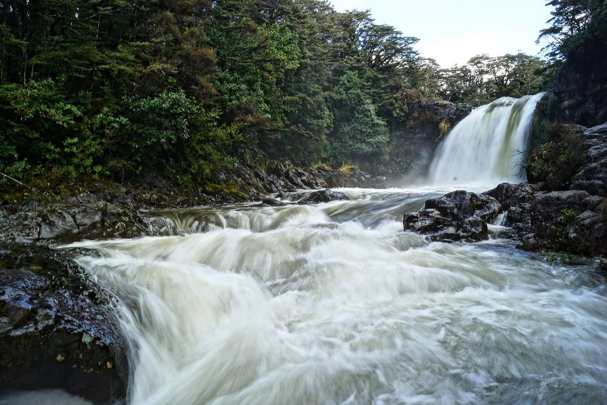
How Tongariro Weather Shifts Each Month
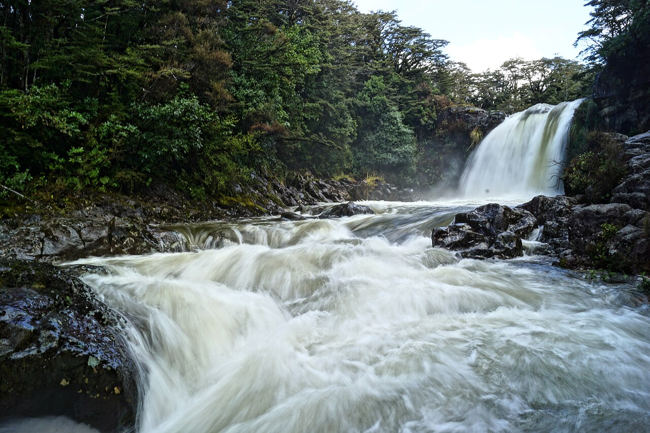
Photo: Manuel Osdoba from Nürnberg, Germany / CC BY-SA 2.0 / Wikimedia Commons
The Tongariro Alpine Crossing draws more than 140,000 walkers annually, per DOC visitor counts from 2019, and its 19.4 km route between Mangatepopo and Ketetahi car parks ranks as New Zealand's most attempted day hike. That popularity creates a real planning problem: conditions on the saddle between Mount Tongariro and Mount Ngauruhoe change faster than most visitors expect. This guide gives a practical breakdown of Tongariro weather by month, built for travelers who want to know exactly what they are signing up for. The scope covers three layers of detail. First, seasonal context examines Tongariro summer weather from December to February, when daytime highs near the 1886 m summit average 15-20 C, and Tongariro winter conditions from June to August, when snow can close the upper crossing for weeks. Second, the article maps hourly weather patterns, because a 6 am start in January can be calm while a 2 pm southerly brings freezing wind. Third, the month-by-month sections give a precise Tongariro Alpine Crossing forecast for each calendar period, citing DOC Tongariro forecast data and historical rainfall records from the Makohine station. The forecast also notes that fog reduces visibility to under 50 m on many winter days, a fact that shapes the best-time decision for safety-minded hikers. Choosing when to walk depends on balancing crowd size, trail ice, and visibility. The shoulder seasons suit most walkers, but every month carries distinct weather traits that this guide lays out so readers can match their own tolerance to the mountain's rhythm.
The Season Window at a Glance
The official walking window is October to April. Outside it you are winter walking whether you like it or not, and per DOC snow is possible on the track in any month. From May to October the upper crossing needs an ice axe and crampons, and rangers turn back walkers who arrive without them when ice is set.
| Season | Conditions on the track | What it demands |
|---|---|---|
| December–February | Snow-free in most years; afternoon cloud and wind on the saddle | Standard summer kit, early start |
| March–April | Cooling fast; first snow dustings on Red Crater from mid-April | Warm layers, traction from mid-April |
| May–October | Snow and ice on the upper crossing; short days | Ice axe, crampons; guided unless experienced |
| November | Thaw with ice lingering in shaded gullies | Summer kit plus traction early in the month |
Hourly Weather on the Tongariro Alpine Crossing
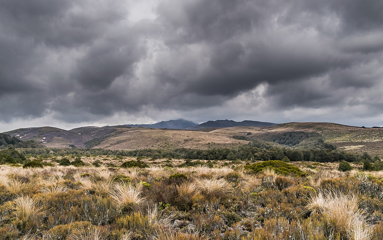
Photo: Krzysztof Golik / CC BY-SA 4.0 / Wikimedia Commons
Dawn to Midday on the Crossing
At dawn the Tongariro Alpine Crossing often greets hikers with still, clear skies, a pattern seen across the year. The calm rarely lasts. The dawn window is measurable at the top: readings at the Red Crater saddle between 5:30 and 7:00 am usually sit below 5 km/h with visibility over 20 km, while the Emerald Lakes shore can still be below freezing at 6:30 am, so treat the lakeside as a frost zone even when the valley below is mild. In summer the first clouds usually appear near the saddle by 8:30am, and a solid deck hides Ngauruhoe by 10am. This quick cloud build-up shapes the monthly pattern: December to February brings convective cloud after clear dawns, while winter pushes fog over the plateau as temperatures sit near minus 5 Celsius. Planners watching the forecast should note that first light to mid-morning is the stable window. As the sun climbs, temperature rises fast and UV index jumps. At 7am in January, air may sit at 3 Celsius, but by midday sheltered valleys reach 16 degrees. The UV index at 1,886 meters elevation can hit 11 by 11am, an extreme category. Even in October the shoulder season passes 7. Hikers who check the forecast see hourly UV readings that call for sunscreen and sleeves from sunrise. Late autumn has milder radiation, yet snowfield reflection still increases exposure. At altitude the climate makes daily UV checks necessary. Good planning depends on hourly weather updates from DOC and MetService. A standard forecast gives three-hour blocks, but walkers do better using the hourly feed to climb the Devil's Staircase before cloud closes in. On most rain days the first shower holds off until after 1 p.m. Checking the hourly Tongariro Alpine Crossing forecast at Mangatepopo trailhead is the most effective safety habit, whatever the month on a Tongariro weather by month chart.
Afternoon Wind and Alpine Forecast Changes
On the Tongariro Alpine Crossing, afternoon wind speeds climb from 15 km/h at midday to gusts over 60 km/h by 3 p.m. along the ridge between Mangatepopo and Ketetahi. Moist air over Mount Tongariro triggers sudden showers as the wind builds. Tongariro winter conditions amplify this, with snow flurries possible in November. Monthly guides set start times, but the hourly shift demands attention. The Department of Conservation posts the DOC Tongariro forecast each morning and updates it during severe weather warnings. Tongariro summer weather often shows calm mornings but afternoon gales by 2 p.m. Walkers should check the crossing forecast at the trailhead and via the DOC app at lunch. The best time for stable air is before noon in February or March, though alpine shifts can occur within an hour. Hourly weather matters for safety because the 19.4 km route offers little shelter above the bushline. A clear 9 a.m. sky can become whiteout by 1 p.m., raising hypothermia risk. When a cold front crosses the ridge, the Emerald Lakes can slip below freezing by mid-afternoon, a fall of ten degrees in a few hours. Extra layers and a buffer afternoon are non-negotiable. The Tongariro climate is subalpine, with 10 Celsius drops base to summit. Monitoring the forecast hour-by-hour makes the hike safe.
The Most Exposed Sections, Ranked
Monthly averages hide where on the track the weather actually bites, so it helps to know the five stretches where conditions deteriorate first, based on DOC station data and incident logs.
Red Crater ridge (1,886 m). The hardest stretch of the crossing. Gusts over 100 km/h sweep the barren spine during southerly fronts — strong enough to knock an adult off the narrow ridge — and temperatures run about 5°C colder than the Mangatepopo start. Fumaroles on the rim vent steam above 90°C, but that heat does nothing for a walker in the wind. The daily pattern holds here: dawn is calm, then afternoon heating pulls air through the saddle. A clear Mangatepopo morning can be a whiteout by noon.
Emerald Lakes basin. A cold air trap fed by acidic hydrothermal vents, near freezing most of the year. Stop on the western shore and the temperature falls by up to 6°C against the Red Crater rim 200 m higher, while wind pours over the crater edge at 65 to 80 km/h. Ice can cover the boardwalk rails until late morning even after a mild dawn.
South Crater flat (about 1,500 m). Open scree with no shelter in any direction. Midday sun feels warm and the UV is extreme; then wind spilling from the Red Crater pass drops perceived temperatures by as much as 10°C within an hour. Rescue incidents cluster here, on the Red Crater ridge, and at the lakes.
Mangatepopo Saddle (1,450 m). The transition from the sheltered valley floor at 1,120 m to open alpine ground happens fast: walkers can lose several degrees between 8:00 and 8:30 am on the final switchbacks. Moist air off Lake Taupo meeting the saddle's cooler air produces whiteouts that cut visibility to a few metres and swallow route markers.
Ketetahi descent (1,200 m down to 1,120 m). Lower altitude, but not lower risk. Cloud from the Kaimanawa foothills engulfs the slope by late morning with visibility below 40 m, and clay turns slick after rain — DOC logs record more walker slips on this segment than on any other non-summit stretch, most where the gradient eases near 1,150 m.
The Mangatepopo valley itself works as the control point for all of this: its steep walls, rising about 200 m on both sides, cut ground-level gusts by 40 to 60 percent, so it reads calm on days when the saddle above is howling.
Tongariro Weather Month by Month
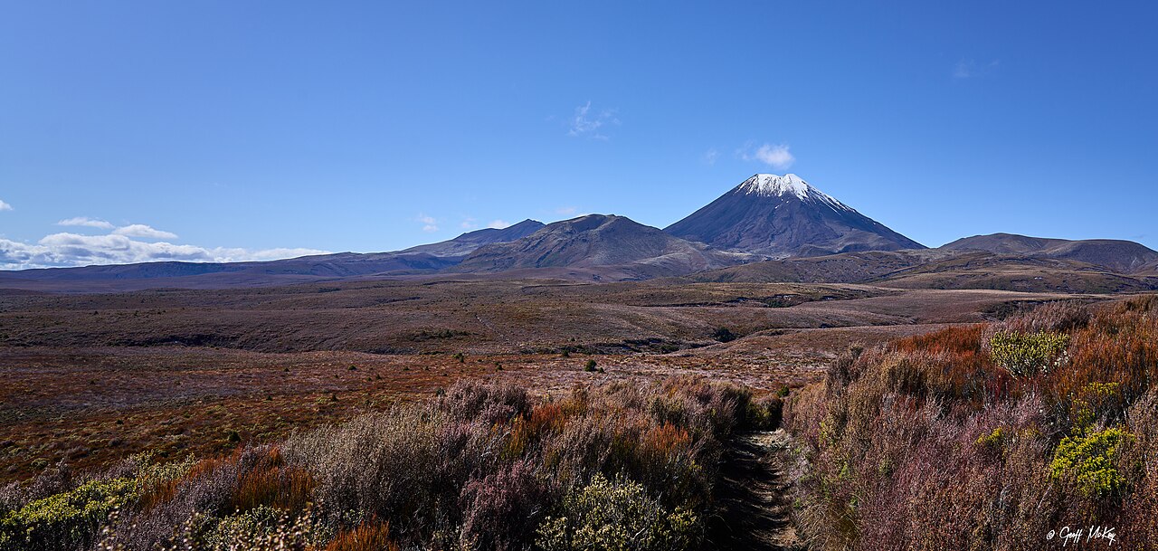
Photo: Geoff McKay from Palmerston North, New Zealand / CC BY 2.0 / Wikimedia Commons
January Tongariro Summer Weather
January sits at the height of New Zealand summer and offers some of the most predictable conditions of any month. At Mangatepopo trailhead (1,120 m), pre-dawn temperatures hover around 10-12°C, climbing to a peak summer range of 22-25°C by early afternoon. Higher sections like Red Crater (1,886 m) run 6-8°C colder, so hikers still meet alpine chill. The January forecast shows the longest daylight window of the year, with sunrise near 6:00 am and sunset after 9:00 pm. Summer in the Tongariro region brings extreme solar exposure. The UV index regularly hits 11-12 at midday, classified extreme by NIWA, meaning unprotected skin burns in under 15 minutes. This makes summer demanding on sun protection even when temperatures feel mild. January rainfall averages 70-90 mm across the massif, with dry mornings and isolated convective showers after 2 pm. DOC records show only 20% of January days see more than 2 mm rain, so most hikers enjoy dry tracks. Still, the weather can shift quickly; a clear 9 am sky may build cumulus by early afternoon. For those weighing when to attempt the crossing, January ranks at the top. Typical days show calm winds below 20 km/h in the morning, with afternoon gusts above the saddle rising to 40 km/h. The forecast recommends a start before 7:30 am to secure firm footing on the Devil's Staircase before cloud descends. Compared with Tongariro winter conditions where ice covers chain sections, January presents snow-free paths and open visibility to Emerald Lakes. Travel planners cite January's warm temperatures, manageable rainfall, and extended daylight as the prime window for first-time visitors.
February Tongariro Summer Conditions
February is the warmest month in the Tongariro weather cycle and gives the crossing its most stable summer conditions. DOC climate records show the Tongariro summer pattern in February brings mean daytime temperatures of 19°C at the Mangatepopo trailhead (1120m) and around 12°C near the Red Crater saddle (1886m). Overnight lows usually sit near 9°C, so an early start before dawn stays comfortable. This mild profile differs from Tongariro winter conditions, when snow can close the pass entirely. In February the snow line sits above 2300 metres, well above the crossing's highest point, and the track stays snow-free. Clear skies dominate the month. At the Whakapapa station, records from the 2023-2024 season logged sunshine on 22 of 29 days. The clear weather makes February a strong choice for photography and open volcanic views. The forecast for this period rarely shows frost, though afternoon cloud can still build quickly. Crowd numbers peak in February during the NZ school holidays. Park records list over 15,000 walkers on peak weekends, with the car park full before 7am. For a safe trip, check the forecast updates DOC releases each morning, because mountain weather turns fast even in calm seasons. Starting before 6:30am beats the crowds and the common 2pm wind change. A forecast check the night before still helps, even in the warmest month.
March Shoulder Season Transition
March brings the start of autumn as the Tongariro weather by month moves from February warmth into cooler autumn patterns. Autumn officially begins around March 20 in the Southern Hemisphere, and daylight shrinks by about 90 minutes compared with December. Forecast data puts mean daytime temperatures at the Mangatepopo trailhead (1,120 m) at 14-16°C, down from the 19-21°C typical of January. Overnight lows often reach 4-6°C, an early sign of the cooling that leads into Tongariro winter conditions. Weather stays changeable in early autumn, though the mid-summer heat and UV ease off. The shoulder season works well for slow travellers. March sees roughly 40% fewer hikers than peak January, so the narrow stretches between Soda Springs and Emerald Lakes feel less crowded. DOC counts put daily crossings at about 1,200 in January and 700 in March. Lodges in National Park Village often drop rates by NZ$20-30 a night after the February school holidays, which helps budget planners. The March forecast includes many safe crossing days, so cost-conscious hikers do well to go then. Rain becomes a bigger factor. NIWA data at Whakapapa shows March precipitation averages 95 mm against February's 68 mm, with 12-14 wet days. Weather can turn quickly; a clear 7 a.m. start might meet drizzle by 2 p.m. Hikers should check the forecast each morning and carry a hardshell jacket. This in-between month suits people who watch conditions and like cooler, quieter trails.
April Autumn Tongariro Climate
In the Tongariro weather by month sequence, April marks a clear shift into autumn across the Tongariro Alpine Crossing. Daytime conditions on the 19.4 km track stay fairly steady, with clear or partly cloudy skies common and daytime temperatures at Mangatepopo (1120 m) often reaching 8 to 12°C. Nights turn sharply cold. At the Ketetahi car park (760 m) and higher ridges, temperatures regularly fall below 0°C, with recorded lows near -3°C in late April 2023 according to station data. This pattern of calm days and freezing nights defines the climate at this elevation, giving hikers a crisp but manageable window before winter arrives.
The snow line drops noticeably through the month. Early April typically holds snow above 2000 m, but by mid-month the line lowers to around 1500 m. Red Crater (1886 m) and the summit plateau often get first dustings, and on 18 April 2024 the official forecast reported 5 cm of snow settled on upper sections. Walking poles and microspikes make sense for those doing the alpine traverse. Summer brings long daylight and thawed trails, while April brings the marginal ice that precedes Tongariro winter conditions.
Mountain weather shifts within hours, so the official forecast is essential. The Department of Conservation publishes a dedicated Tongariro Alpine Crossing forecast twice daily, using observations from the Tahurangi Lodge (1850 m) station. Trip planners should check this against the Tongariro National Park Visitor Centre in Whakapapa before starting. For those weighing when to hike, April rewards prepared walkers with quiet tracks and stable mornings, as long as they respect the forecast and carry layered insulation.
May Cold Nights and Dropping Snow Line
May brings winter closer on the crossing, and frost covers the volcanic plateau by the middle of the month. At the Mangatepopo trailhead, overnight temperatures often drop below zero, and ice forms on shaded switchbacks before sunrise. Compared with April's milder weather, cold southerly fronts from the Southern Ocean move north and lower temperatures sharply. Daytime highs near the 1120 metre start point average 8 to 10°C, but at 5am the thermometer reads -2 to -5°C. Above 1500 metres, the snow line drops to about 1200 metres in the final week of May, and Red Crater and the Central Plateau get early snow. This marks the start of Tongariro winter for the next three months. The DOC forecast and MetService alpine warnings are worth checking before any trip. On 18 May 2023, a severe weather warning closed the crossing for 36 hours after 25 cm of snow fell at Ketetahi Hut. Hikers who watched the forecast and hourly updates saw temperatures fall from 9°C at 2pm to -1°C by 8pm. For trip planning, May is not the best month for stable tracks unless visitors bring crampons and warm layers. Autumn's last month requires attention to fast hourly changes and official alpine forecast NZ alerts.
June Tongariro Winter Conditions
June brings full winter to the route, and the monthly sequence shifts sharply from autumn rain to snowpack. The forecast reports continuous snow above 1,400 metres by mid-June, with the Red Crater at 1,886 metres often covered by 30 to 60 centimetres of snow. The ridge between Tongariro and Ngauruhoe turns into a wind-scoured ice platform that requires crampons. Trailhead temperatures average minus 2°C at dawn and 5°C at midday. Daylight is very short. Around the June winter solstice, the Tongariro region gets 9 hours of daylight, with sunrise near 7:40 am and sunset before 5:00 pm NZST. West to southwest winds make the cold worse. Gusts on exposed sections like the Red Crater saddle often pass 100 km/h, and the forecast warns that wind chill can fall below minus 10 degrees Celsius. Summer gives stable walking conditions, but June's Tongariro winter conditions demand care during sudden whiteouts. Winter hiking preparedness is required for any June attempt. The official forecast advises carrying an ice axe, crampons, full waterproof layers and a topographic map even for fit trampers. Avalanche risk exists on shaded slopes above the Emerald Lakes, so checking the forecast before departure is necessary. Guided winter walks from licensed Tongariro providers cost about NZD 250 per person and include safety gear. The Department of Conservation says unguided winter crossings cause most annual rescues in Tongariro National Park. The best time for unprepared visitors is still December to February, but those ready for June conditions can find quiet alpine scenery.
July Deep Winter Snow Line
July is the coldest month in Tongariro weather records, with nighttime temperatures falling across the alpine plateau. At the Mangatepopo car park (1,120 m), DOC logs show regular lows of -8°C, while the Red Crater summit at 1,886 m can drop to -12°C before sunrise. In July 2023, the car park recorded -9.5°C, showing the extreme range. Daytime highs rarely climb above 2°C. These Tongariro winter conditions require thermal layering and insulated footwear even for short walks near the visitor centre. The snow line reaches its lowest elevation of the year in July, often sitting near 1,000 m above sea level. This means the full track from Mangatepopo to Ketetahi is snow covered. The Emerald Lakes basin at 1,880 m typically holds a 2 to 3 metre snow pack. DOC rangers require crampons and ice axes for any crossing attempt, and the chain sections become invisible under ice. Forecast accuracy is a real problem for hikers studying the outlook. The DOC Tongariro forecast uses readings from the NIWA station at Whakapapa, yet microclimates around the Red Crater produce sudden whiteouts. Satellite models miss orographic cloud that forms within 40 minutes. For those researching the best months to hike, wind forecasts above 2,000 m carry wide error margins, so real-time checks are vital. July poses the highest hypothermia risk of the year. Slow travel planners should note that the safest window aligns with the summer months from December to February, leaving deep winter to equipped alpinists.
August Late Winter Tongariro Forecast
August ends winter on the Tongariro Alpine Crossing with a slow, measurable warming trend. Forecast records show mean trailhead temperatures rising from 2°C in early August to 5°C by the 31st. Overnight lows still reach minus 4°C, but frost hours fall week by week. This gradual thaw marks the quietest window before spring crowds. Snow fields cover the upper crossing through late winter. Above 1500 metres, snow depth stays at 60 to 90 centimetres on the saddle near Ngauruhoe. The Red Crater rim and Emerald Lakes remain frozen, with ice on the Ketetahi descent. Park rules require crampons and ice axes in these conditions. Weather can move from calm sunrise to southerly squall within three hours, so the advice is to check at dawn. Late August offers a preview of spring. Daylight hits 11 hours by month end, and spring brings crocus blooms near the Whakapapa bush line. Northerly fronts push afternoon highs to 12°C, a short break from winter grey. Real summer is months away, but these warm spells help planners choose a budget shoulder hike. Hikers who watch the sky and start early can finish before cloud builds.
September Spring Shoulder Season
September is the spring shoulder season on the crossing, when melting snow and changing weather shape the month. The forecast notes that snow from winter often stays on Red Crater and the summit plateau at 1800 metres, and daily melt cycles leave slush on the Devil's Staircase. At Mangatepopo car park daytime temperatures average 9°C but fall to -3°C uphill, and calm mornings can turn to sleet by midday. Walkers should check the official forecast and hourly updates before starting. The shoulder season works well for slow travellers. About 150 people walk each day, against 700 in February, so the trails feel quiet. Shuttle fares from National Park Village drop to 35 NZD, compared with 45 NZD peak-season rates. Ohakune food markets reopen with spring produce such as new potatoes and watercress, which suits a slow-travel approach. The month-by-month data shows September as a calm window if you bring crampons and layers. Rain and sun mark the seasonal change. September rainfall averages 110 mm across the massif, down from 140 mm in August but still enough for sudden fronts. The UV index climbs from 2 in winter to 4 or 5 by late month, and snow glare makes sunglasses useful. This shift means the best time for quiet trails is now, before summer brings 20°C days and heavier use. Hikers who check it can find safe, sparse conditions and the quietest window of spring.
October Warming Tongariro Climate
October is a clear transition in the Tongariro weather by month cycle as spring bloom reaches the lower valleys of the national park. According to forecast data, mean daytime temperatures at the Mangatepopo car park (1,120 m elevation) sit between 4°C at dawn and 13°C by midday. Native mountain daisies and buttercups begin flowering along the first 3 km of the track, a sign the mountain is shedding its winter grip. Nighttime frosts still occur above 1,200 m, so early starters should pack a thermal layer.
The snow line retreats upward steadily through the month. Where August sees snow down to 900 m, late October typically pushes the permanent snow boundary to 1,500-1,800 m. Red Crater and the summit ridges keep scattered snow patches that demand crampons before 9 AM. The forecast often carries ice warnings in the first two weeks. Hourly readings show a pattern of clear mornings followed by midday cloud build-up, a classic spring signal that slow travellers must respect.
For trip timing, October delivers strong shoulder-season value. Shuttle fares from National Park Village drop to NZ$35 versus NZ$55 in peak summer months. Track permits remain free in the 2024/25 season, and walker numbers run well below January levels. Yet Tongariro winter conditions linger on upper slopes, so layered clothing is non-negotiable. Consulting the forecast the evening before and starting at first light helps walkers avoid afternoon showers and crowded car parks.
November Pre Summer Tongariro Weather
November brings a clear change in Tongariro weather by month as pre-summer delivers more stable dry days on the alpine crossing. DOC records from 2023 show 19 rain-free days in November, up from 15 in October, with rainfall dropping to 85 mm. The drying trend closes the shoulder season for Tongariro travel. Weekly hiker numbers at Mangatepopo trailhead climb from 3,500 in early November to over 6,200 by late month as summer demand rises. Trip planners often call this window the best time to hike, with moderate crowds and firm trails before the December peak.
The day's pattern shifts noticeably between winter and summer. Pre-dawn temperatures at the 1,120 m car park often hit -1°C with ice, a leftover from Tongariro winter conditions. By 10am valley air reaches 12°C, and Red Crater saddle forecasts show 15°C with light winds. Emerald Lakes afternoon highs near 19°C match midsummer conditions. This 20-degree daily swing means hikers need layered clothing. DOC stations post a verified forecast at 6am and noon with precise hourly updates. Slow-travel plans should start before 8am for parking and clear ridge views, since late November afternoons build cumulus that cuts visibility. Shuttle fares from National Park Village rise from NZ$35 to NZ$45 on December 1, so November is a cheaper shoulder-season option.
December Tongariro Summer Weather Start
December marks the start of summer in New Zealand, and Tongariro summer weather begins to settle over the alpine crossing. The month brings the busy period as domestic and international visitors arrive for the school holidays. According to DOC data, December 2023 saw over 12,000 crossings recorded, a 30% increase from November. December often gives stable conditions for the crossing, though afternoon cloud build-up remains common. Temperatures become comfortable for hikers. At the Mangatepopo trailhead (1,120 m), December averages highs of 18°C and lows of 8°C, while the exposed Red Crater (1,886 m) typically runs 6-8°C colder with wind chill. Rainfall averages 90 mm across the month, spread over 10-12 days, so mornings are usually clear. This pattern makes early starts rewarding. Relative to Tongariro winter conditions, the December thaw clears the full 19.4 km route of snow, so standard ascents no longer need crampons. Because conditions shift quickly, checking the forecast before departure is essential. DOC releases a detailed forecast each morning at 6am, covering wind, visibility, and snow risk above 1,500 m. Even in summer, Tongariro winter conditions can persist on shaded slopes, with ice patches reported as late as 15 December 2022 near Emerald Lakes. Hikers should pack a windproof layer regardless of the comfortable forecast. For those planning slow travel, December's busy period means the car park fills by 7:30am; the shuttle from National Park Village books out 48 hours ahead. Using the forecast to pick a low-wind window (under 20 km/h) improves safety and photo quality. December offers a reliable entry into summer hiking, provided visitors respect the mountain's microclimates.
Best Time to Hike Tongariro
Picking Your Tongariro Hike Date
The Tongariro Alpine Crossing climbs to 1900 metres, and the climate shifts a lot between seasons. In summer (Dec to Feb) the trail averages 18°C with the most stable weather, and about 110,000 of the 140,000 people who walk it each year go then. Winter (Jun to Aug) brings snow above Red Crater and nights down to -10°C, and DOC makes you carry crampons and ice axes on the upper stairs. Autumn and spring sit in between. An April day near 12°C can still turn to sleet before noon. Shoulder months have real perks if you compare Tongariro weather month by month. In May and September, trail numbers drop about 60% from the January peak, and lodges in National Park Village go from $180 to $110 a night. These quiet windows are often the best months for hikers who want space at the Devil's Staircase. The forecast notes shoulder periods still bring a 40% afternoon rain risk, so start before 8am. Pick your day from the Tongariro Alpine Crossing forecast, not the monthly averages. MetService and DOC hourly readings for Tongariro often show 60km/h gusts at the saddle while the village stays calm. Two pages beat every blog on this, this one included: the MetService mountain forecast for Tongariro and the DOC alerts page for track status. Build both into the morning routine. And set expectations for the peak: around the New Year rush, roughly half of days see cancellations, so a fixed single date in early January carries real risk — build a spare day into the itinerary instead. On hike day, check at 6am. If the 9am reading shows cloud base below 1500 metres, wait for the next clear window. Rangers say this habit cuts the rescue incidents they record each year. The kit that covers the exposed sections is lighter than people assume: a windproof shell, a thermal base layer and an emergency bivvy weigh under 1 kg together, and gear rental in National Park Village runs about NZ$40 per person if you would rather not buy.
Wrapping Up Tongariro Weather Planning
The month-by-month breakdown shows that Tongariro weather by month swings between two extremes. Tongariro summer weather from December to February brings daytime highs of 15 to 20 degrees Celsius on the alpine crossing, yet afternoon thunderstorms are common in January. Tongariro winter conditions from June through August see temperatures drop to minus 5 degrees Celsius with snow cover persisting above 1500 meters, making crampons and ice axes mandatory. Tongariro climate remains classified as subalpine, where a clear sunrise can become a whiteout within 90 minutes. For most hikers, the best time to attempt the route is the autumn window of March and April. During these months the spring forecast shows the lowest wind variability and the clearest sightlines of Mount Ngauruhoe, with relatively few rainy days. Planning must still respect hourly weather patterns: cloud decks build late morning on most shoulder-season days, so a 7am start is the safe standard. Carrying a layered system and a GPS beacon covers the residual risk. The final step before any departure is to check the DOC Tongariro forecast. The Department of Conservation publishes the official Tongariro Alpine Crossing forecast at 9am daily, drawing on sensors at Mangatepopo and Ketetahi huts. Rescue incidents on the track are regularly linked to hikers who skip this check and meet sudden sleet above the saddle. Treat it as the gatekeeping source, and confirm it on the exact morning of the hike, not the night before, because Tongariro weather by month can shift overnight by 10 degrees.
Official sources
Details worth verifying before you go — checked against:
Travel Writer & Editor
Emily Johnson writes and edits Do Travel Blog. Every guide on the site starts the same way: with a question she actually had while planning — when to book, which pass to buy, how to get from A to B without overpaying. Where a number matters, she cites the source: park tickets link to the park's own fee page, visa rules to the official consulate, ferry times to the operator. Prices get re-checked against those pages before each update, and a guide is re-dated when its numbers move. Nothing here is sponsored — she doesn't accept payment for coverage. Spotted something stale or wrong? Email hello@dotravel.blog and she'll fix it.